For several years OIT staff have been collaborating with staff in Environmental Planning and Sustainability, Space Management, Facilities Management, Environmental Health & Safety, and the UCI Police Department to develop detailed Geographic Information System (GIS) data that represent the campus in its entirety. The data can be used to develop custom GIS maps of the campus as a whole or for specific areas, to identify campus features (meaning things on the ground) and their associated attributes, and to extract information associated with individual features or groups of features. Collectively these data products constitute a digital map base, specifically a geodatabase, for the campus. OIT and other campus departments have been using the geodatabase for mapping purposes and for analyzing details of features.
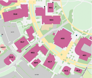
Initial efforts focused on developing data for the greater campus infrastructure including campus buildings, streets, parking, fire lanes and walkways. Subsequently, GIS data representing nearly every square foot of the entire campus have been acquired and added to the campus GIS. Many new data themes now exist such as lawn, shrubbery, mixed landscape, open areas (native plants, water and exposed ground), athletic areas, points of interest, etc. Within each data theme individual features are distinguished by their type and that information is stored in the geodatabase. For example, for the buildings theme there are seven unique types and each type is identifiable on the map by its type color. The detailed map below, covering a portion of Physical Sciences and Biological Sciences Quads, shows several of these data themes that are contained in the campus geodatabase.
Several projects are currently employing the campus geodatabase. In one project, 71 detailed maps covering the campus as a map grid have been made. These maps were developed in conjunction with auxiliary emergency-related data, to support the UCI Police Department and Orange County Fire Authority for emergency response.
You can view the campus GIS map online using the following link:
http://gis.oit.uci.edu/uci/campus/
Campus employees who are interest in using the UCI geodatabase or who are interested in developing their own geodatabase for their research should contact Tony Soeller (tsoeller@uci.edu).

